



OCT 17 | 10:00 PM

All auctions / Books, Maps & Manuscripts / Antique Road Map, London to Hythe, Kent, English, Cartography, John
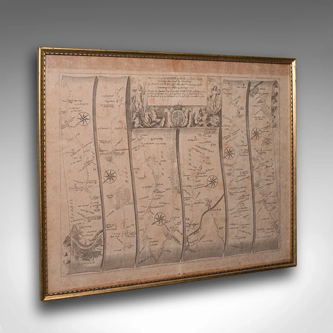
This is an antique Road Map from London to Hythe, Kent. An English, cartographic atlas excerpt by John Ogilby, dating to the late 17th century with later frame, circa 1675 A superb example of early English road cartography, this antique atlas excerpt by John Ogilby depicts the historic route from London to Hythe, Kent. Beautifully preserved and presented within a later glazed frame, this piece embodies the craftsmanship and innovation of Britain’s first road atlas annotated in miles. This is a quality antique road map of London to Hythe, offering remarkable cartographic charm and ready for elegant display in any collection or period setting. Delivered ready to display. Max Width: 48.5cm (19'')Max Depth: 2.5cm (1'')Max Height: 40cm (15.75'') Map Width: 46.5cm (18.25'')Map Height: 37.5cm (14.75'')
Estimate:£525
To the auctionView all items fromLondon Fine AntiquesorBooks, Maps & Manuscripts
Estimate:
£525
OCT 17 | 10:00 PM




OCT 23 | 8:00 AM
Bring your auction to collectors worldwide!
Get listed nowBy subscribing, you are agreeing to the privacy policy. Unsubscribe anytime.
Barnebys HQ
Brahegatan 10
BOX 5038
114 37 Stockholm
