

![[RAPHAEL]. Seconda parte delle logge di Rafele nel Vaticano che contiene](https://bbys.imgix.net/1663/7ec021b255c33d4264c863a42957b28f46451b82f30cb5e0eca40915792e8a0c.jpg?auto=format&w=3840&q=75)







All auctions / Books, Maps & Manuscripts / Italy - Sicily; Nicolas de Fer (1646–1720)

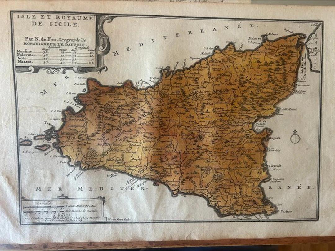
The map offers an incredibly detailed depiction of the island at the beginning of the 18th century, highlighting the orography (the mountainous reliefs and Mount Etna), hydrography, inhabited centers, and the historical administrative divisions of the Kingdom, known as the three “Valleys”: Val di Mazara, Val Demone, and Val di Noto. • Elegant Baroque cartouche containing a table with the geographical coordinates (latitude and longitude) of Messina, Palermo, Noto and Mazara. • Cartouche with the graphic scale expressed in “Italian Miles” and “Hours of walking.” • Wind rose stylized with the lily indicating the North (the map is oriented with North at the top). The map features a beautiful and warm patina of age. There are slight natural foxing and a light, uniform browning that enhance its historical charm. Clean margins and text perfectly legible. No evident invasive restoration.
Estimate:£126.47
To the auctionView all items fromCatawikiorBooks, Maps & Manuscripts
Estimate:
£126.47


OCT 23 | 8:00 AM


OCT 27 | 4:00 PM
Bring your auction to collectors worldwide!
Get listed nowBy subscribing, you are agreeing to the privacy policy. Unsubscribe anytime.
Barnebys HQ
Brahegatan 10
BOX 5038
114 37 Stockholm
