






OCT 23 | 8:00 AM

Bring your auction to collectors worldwide!
Get listed nowBy subscribing, you are agreeing to the privacy policy. Unsubscribe anytime.
Barnebys HQ
Brahegatan 10
BOX 5038
114 37 Stockholm
All auctions / Books, Maps & Manuscripts / Spain - Portugal ; Unknown - Manuscript map of the Iberian Peninsula

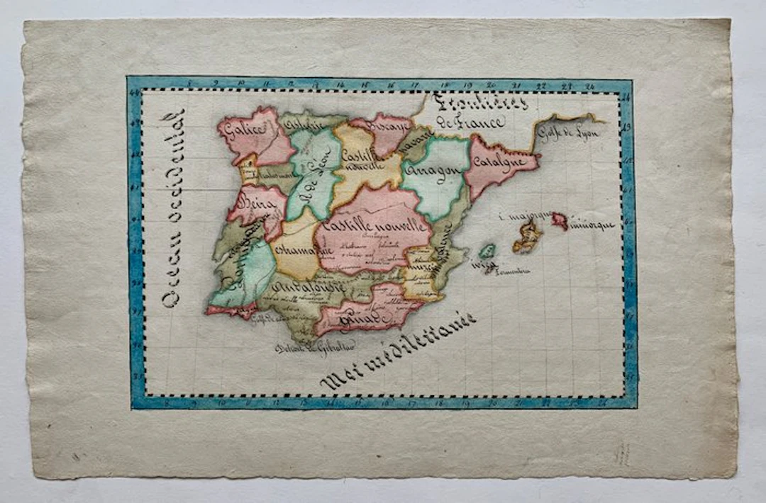
This unique, charming manuscript map depicts the entire Iberian Peninsula, showcasing the historical kingdoms and provinces of Spain and Portugal. The hand-drawn and hand-coloured manuscript map includes detailed hand-inked labels for regions such as Castille Nouvelle, Andalousie, Grenade, Aragon, Catalogne, Galice, Asturie, Biscaye, Navarre, Estremadure, Valence, Murcie, and Beira. The top edge explicitly marks the southern border area of France as "Frontières de France". The surrounding bodies of water are meticulously labeled (Ocean Occidental, Mer Méditerranée, Golfe de Lyon, Detroit de Gibraltar). The border features a classic hand-drawn latitude/longitude scale frame washed in a blue decorative watercolor finish. Italy ca. 1826. Dimensions: 21,5 x 33 cm (drawing), 30 x 46 cm (paper). Good condition. Attention for US buyers: Due to recent export problems higher shipping costs to the US apply!
Estimate:£18.58
Sold for:-
View all items fromCatawikiorBooks, Maps & Manuscripts
Hammer price:
-
Estimate:
£18.58
OCT 23 | 8:00 AM


OCT 27 | 4:00 PM

Bring your auction to collectors worldwide!
Get listed now£40
Est: £30

OCT 17 | 10:00 PM

